


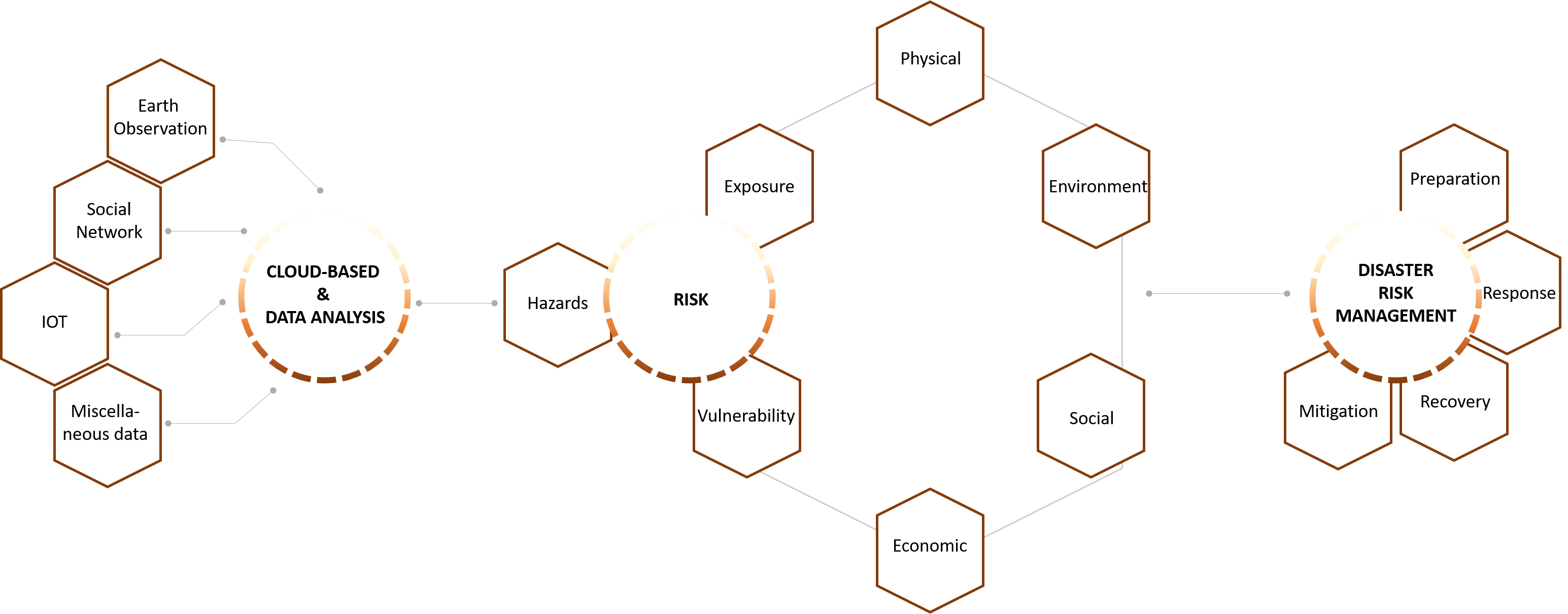
Mapping vulnerability using big data and AI is a collaborative effort of UNDP Cambodia and the Spatial Informatics Group under the auspices of Servir Mekong. In the project we distinguish the vulnerability dimensions of education, health, living standard, employment and monetary. The dimensions are calculated from big earth data using artificial intelligence. Spatial data information layers were derived from satellite imagery, Geo Information Systems and various other sources. We will use the Google Earth Engine technology platform for storing and processing information. Google Earth Engine is a cloud based geo-spatial storage and processing platform which enables users to perform calculations over fast areas and easily share data and work routines.
Artificial intelligence can be very useful to map vulnerability across different dimensions in space and time at the household level. The poverty mapping tool can provide valuable insights into the location and extent of different deprivations across Cambodia and help achieve different Sustainable Development Goals.
Vulnerable group
Gross domestic product (GDP)
Crop lands
United States Agency for International Development (USAID)
The National Aeronautics and Space Administration
Asian Disaster Preparedness Center