

The Mekong X-Ray is an open-source web application for a multidimensional flood vulnerability assessment, including mapping physical, social, economic, and environmental dimensions to support flood risk management.
The tool translates big earth data by applying the state-of-art from Google Science and technologies such as Google Earth Engine (GEE), Google Data Analytics with Big Earth Data including Earth Observation, Social Networks, IoT and Miscellaneous data to flood vulnerability information across different spatial and temporal scales. The application aims to improve flood risk assessment and provide people with insightful information for better flood preparedness and response.
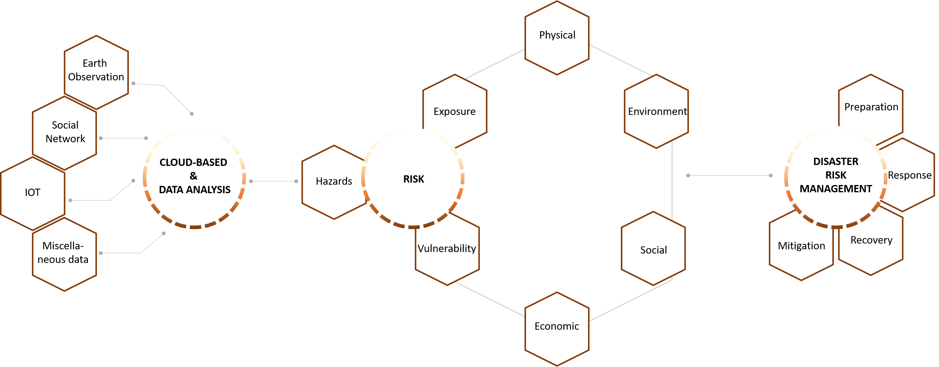
The application applied a conceptual framework for disaster management using big earth data and the different components of the disaster risk assessment framework. Big Earth Data has four components of earth observation, social networks, IoT and miscellaneous data for data collection. Various data sources can be used to feed this data into the risk components of hazard, exposure and vulnerability. The exposure component has the physical, environmental, social and economic components. The translation of data is done in the risk assessment part where the three components are calculated. This information can then be used in the disaster risk management cycle to support the decision-making throughout preparation, response, recovery and mitigation.
Data description
Multi-dimensions of vulnerability 2022
Disclaimer
The information provided on this website is not official U.S. Government information and does not represent the views or positions of the U.S. Agency for International Development or the U.S. Government.
Number of population
Number of vulnerable group
Gross domestic product (GDP)
Crop lands